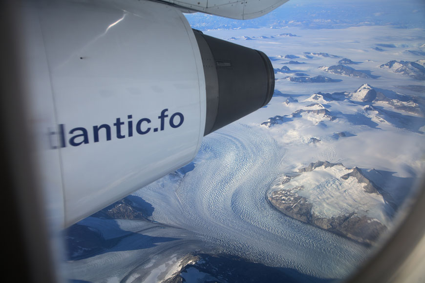
flying in to Narsarsuaq |
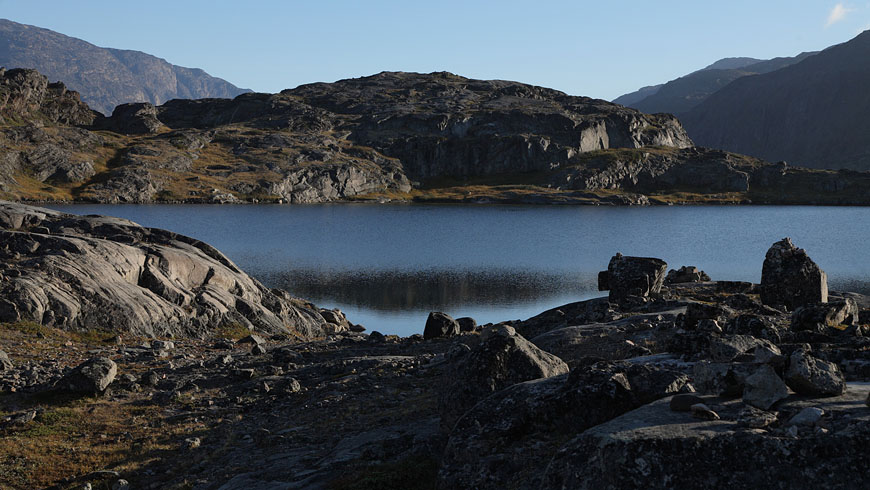
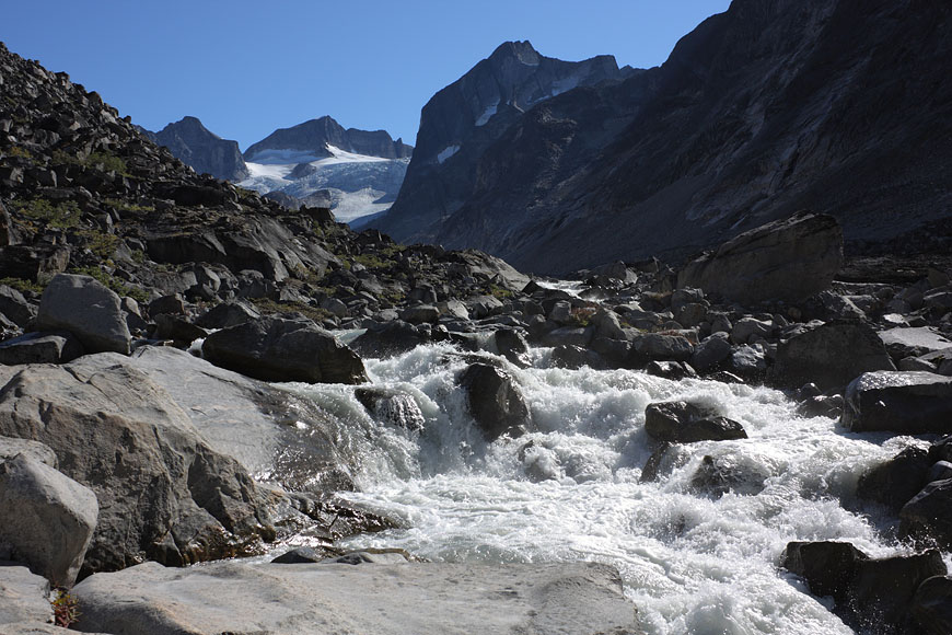
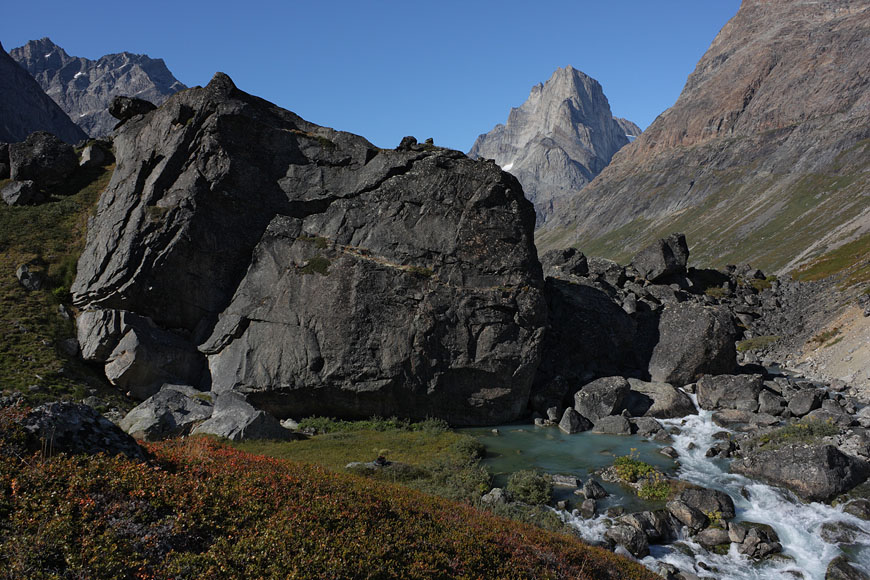
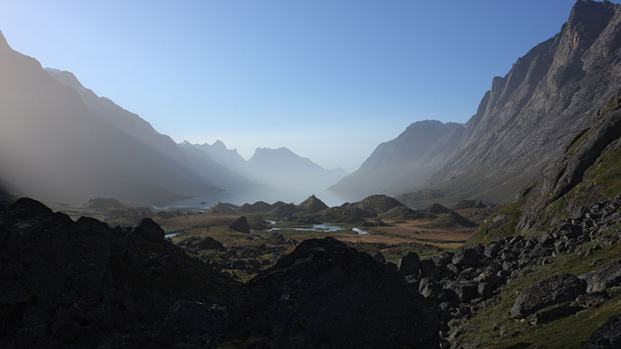
on the way into the Kuusuaq valley for one night camping |
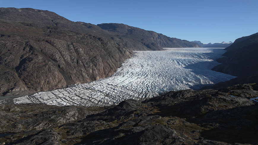
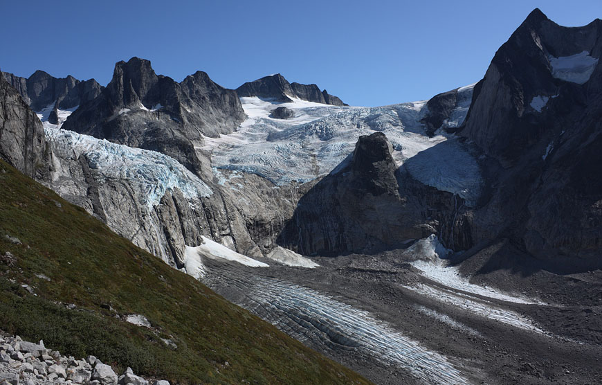
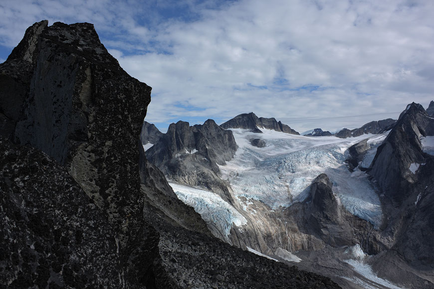
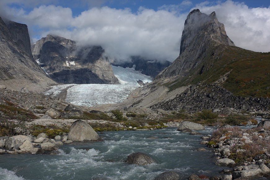
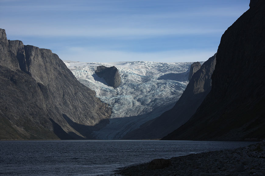
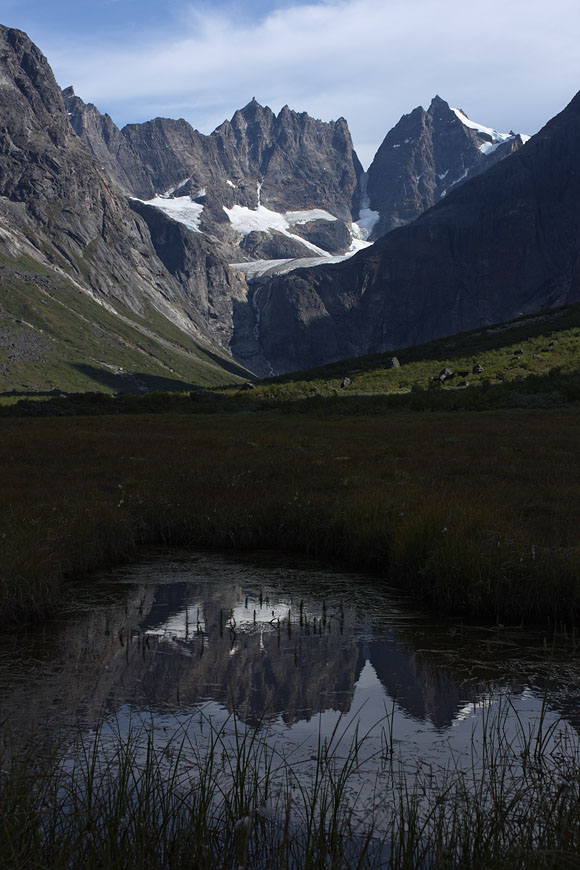
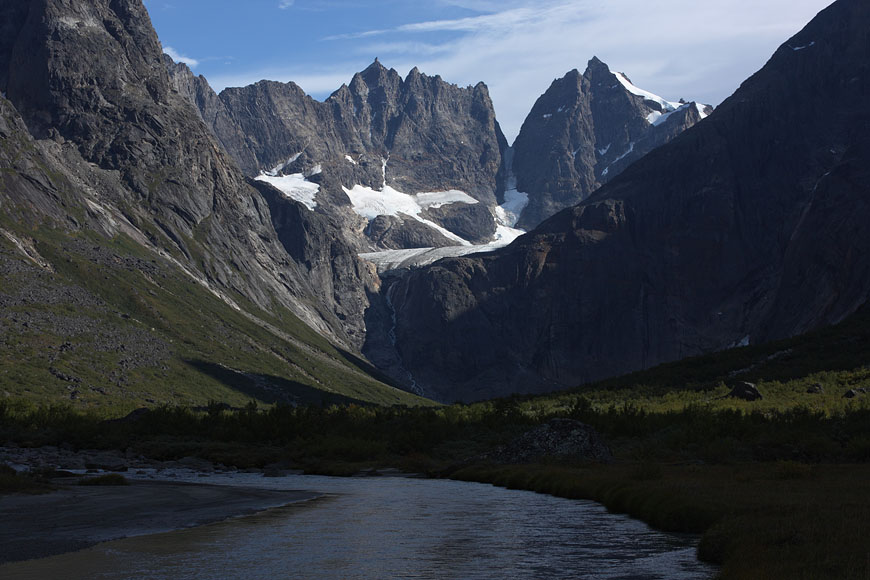
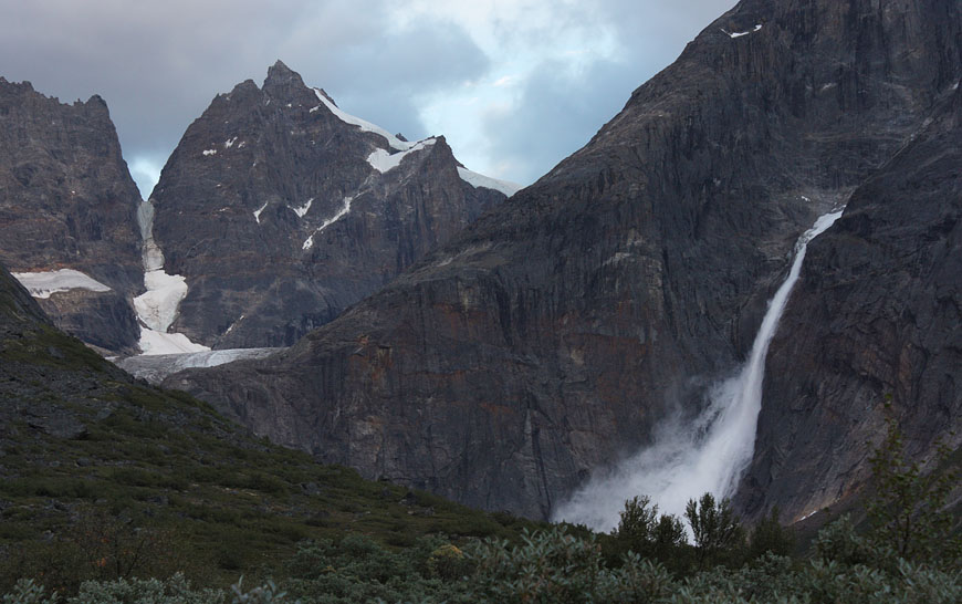
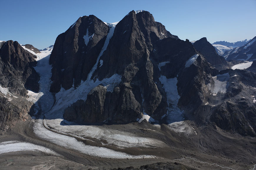
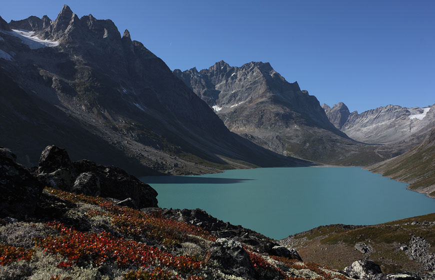
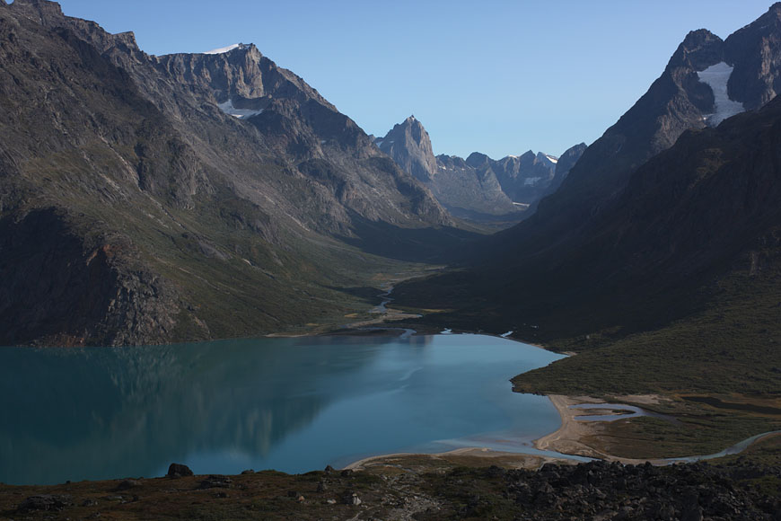
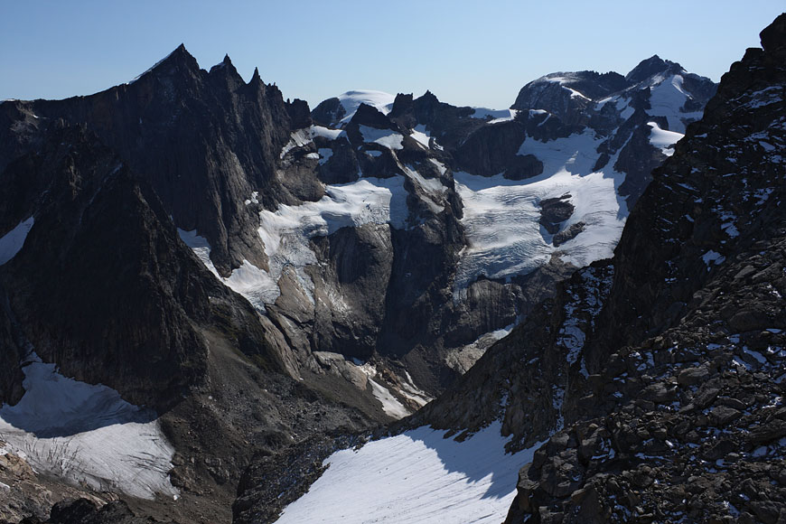
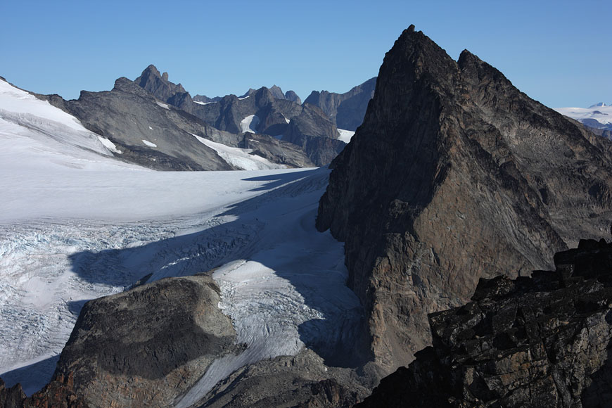
view to Kuussuup sermia glacier |
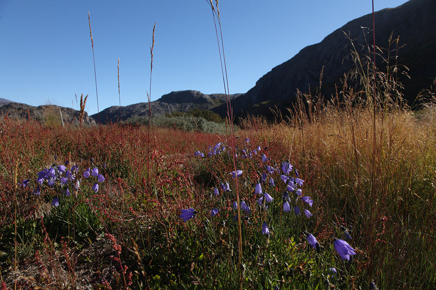
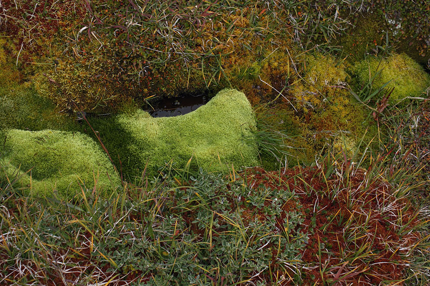
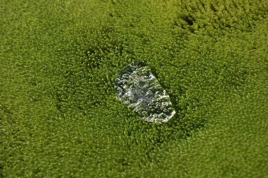
dense vegetation on the way back to the airport |
on the way to Nanortalik |
many villages between demanding multiple stopovers |
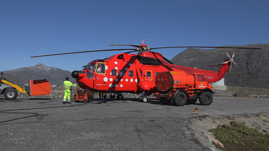
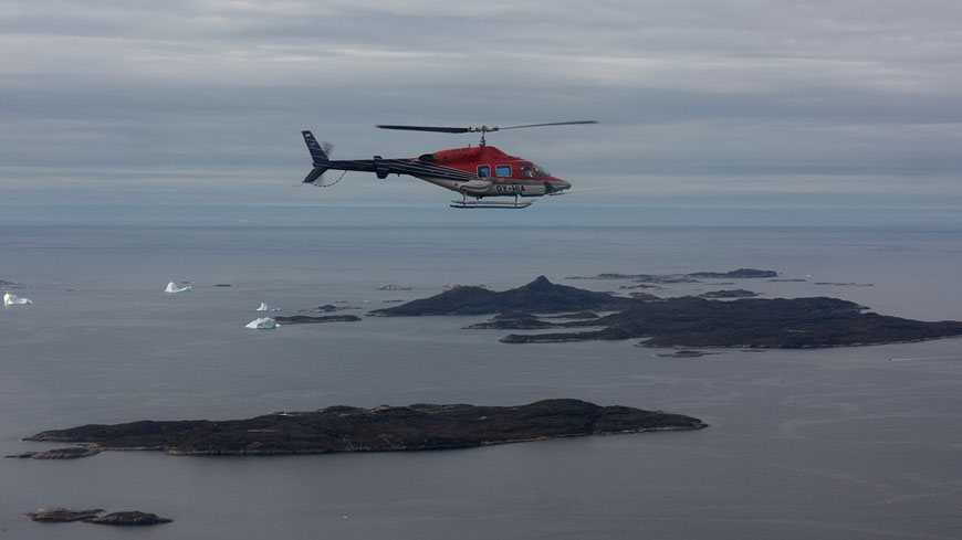
all inland flights in this area are done with helicopters |
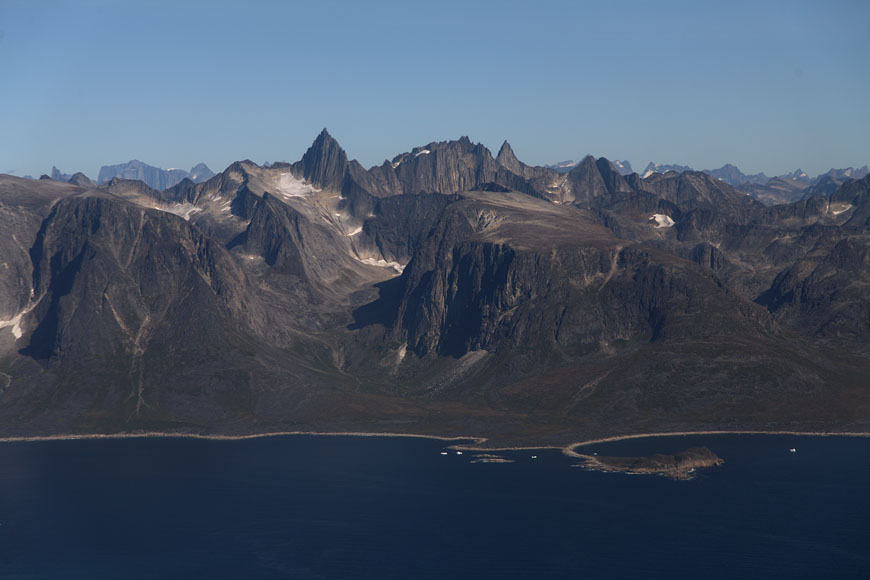
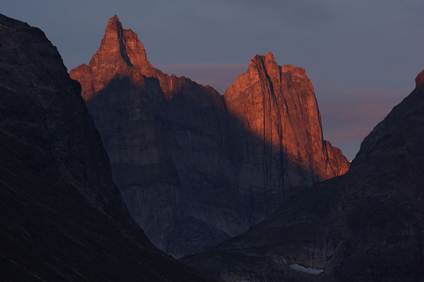
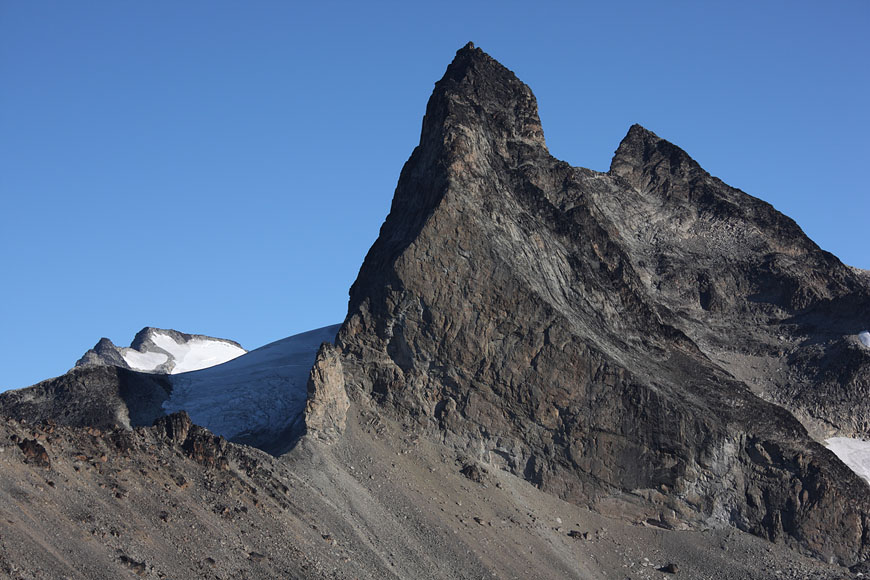
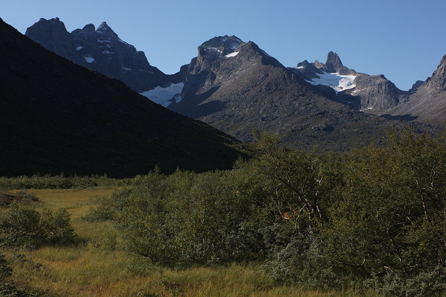
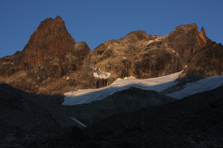
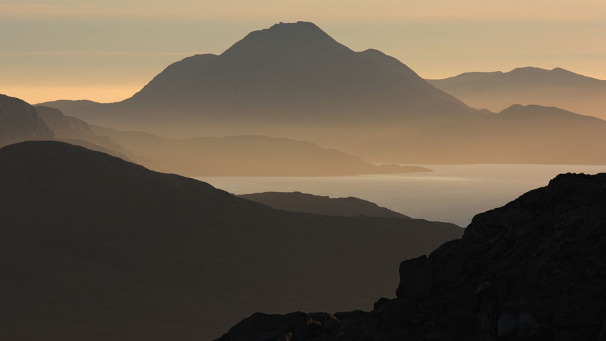
mountain ranges getting steeper when nearing to Nanortalik area |
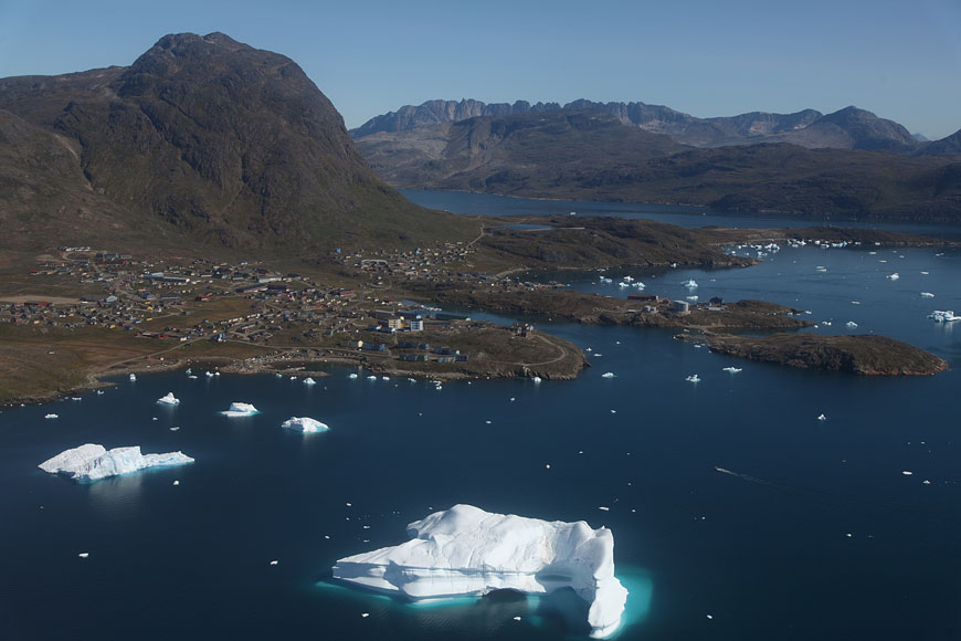
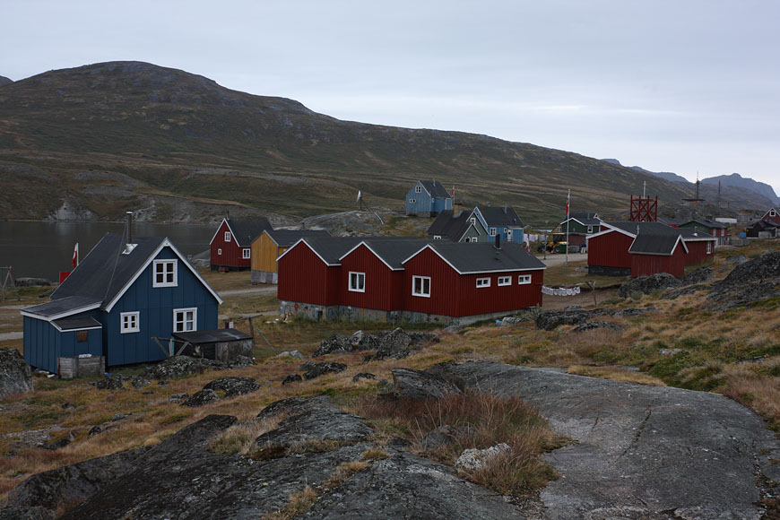
arrival in Nanortalik |
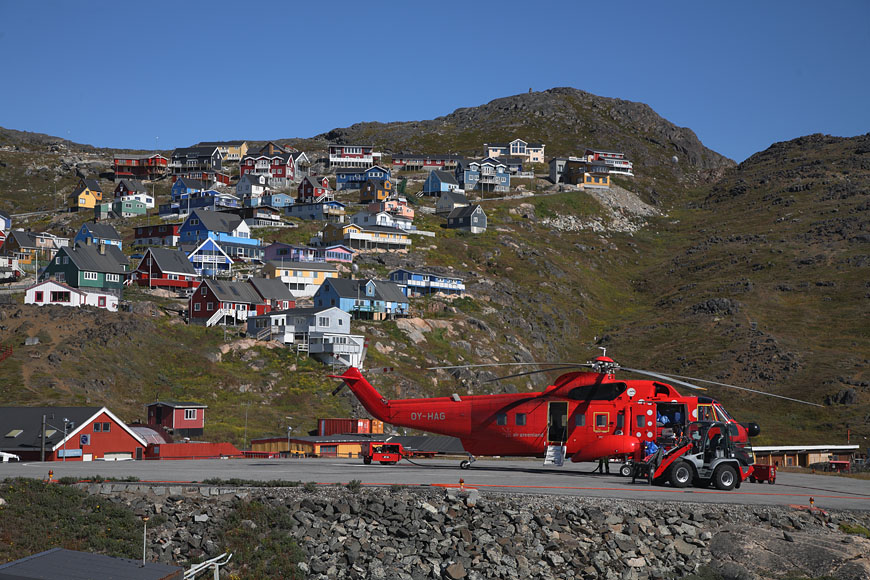
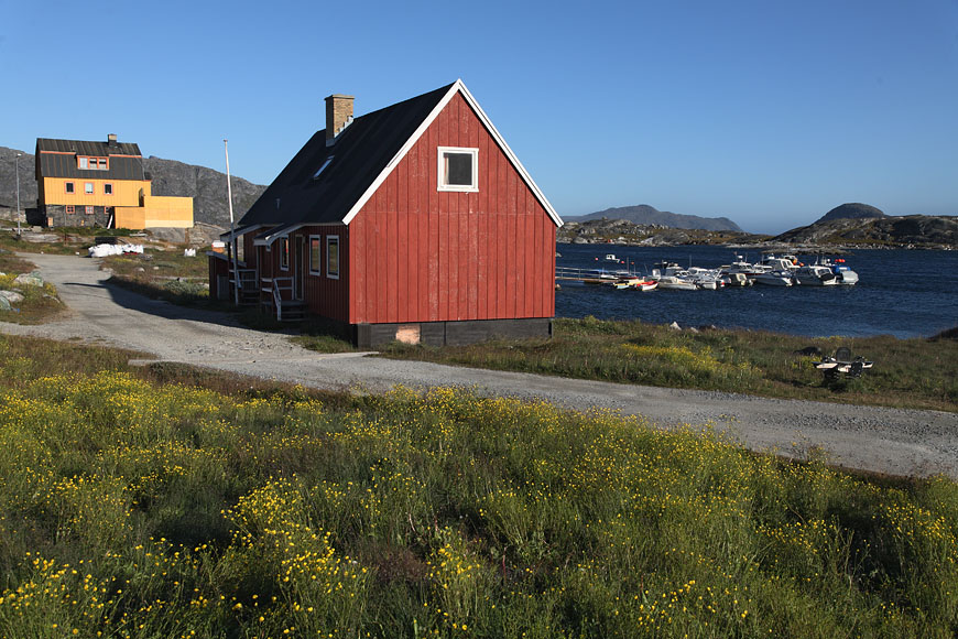
Nanortalik houses |
Nanortalik church |
making extended walks around Nanortalik island, Nanortalic village below (mid of image) while waiting for chartered Inuit boat |
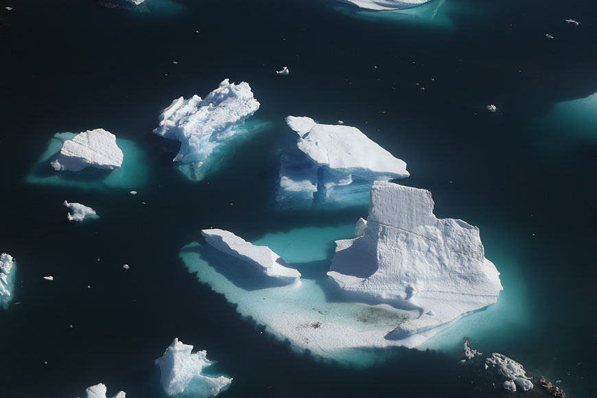
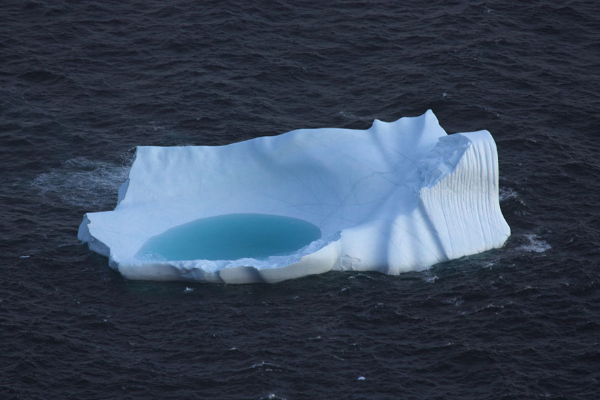
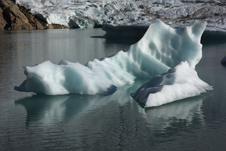
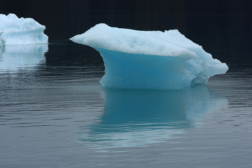
lonesome iceberg |
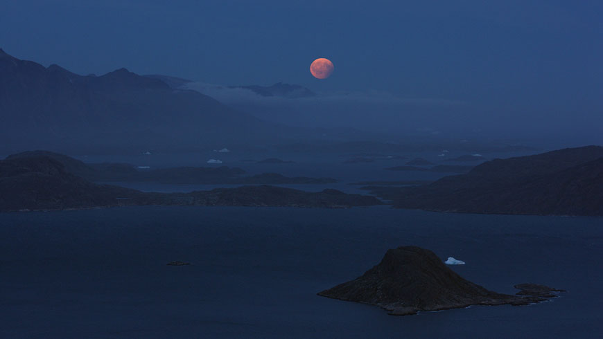
total lunar eclipse at dusk |
|
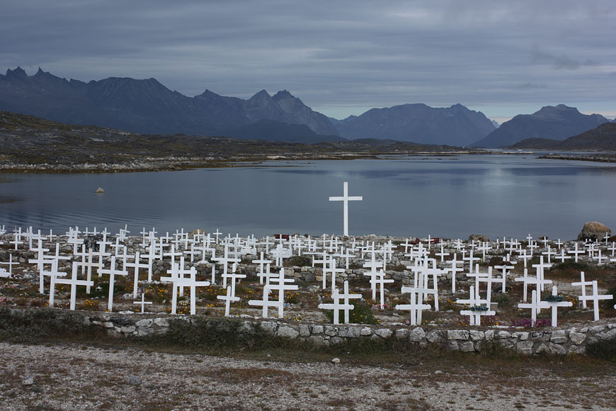
Nanortalik cemetery |
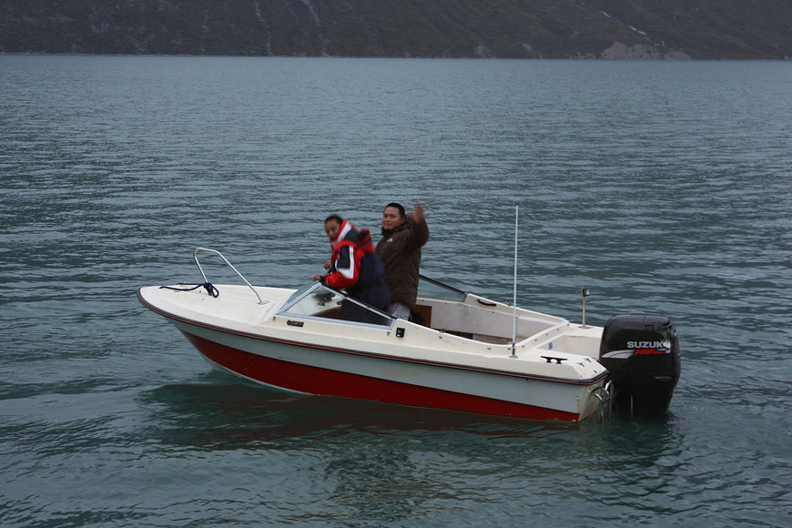
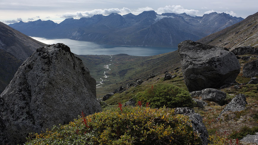
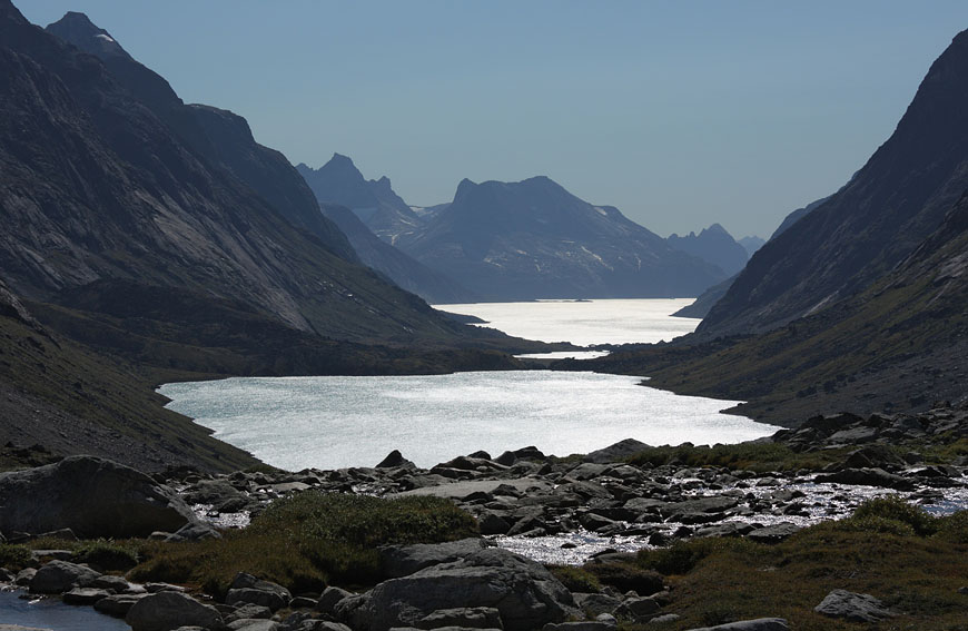
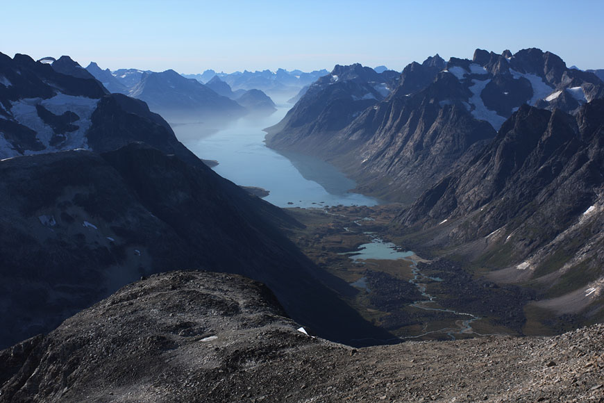
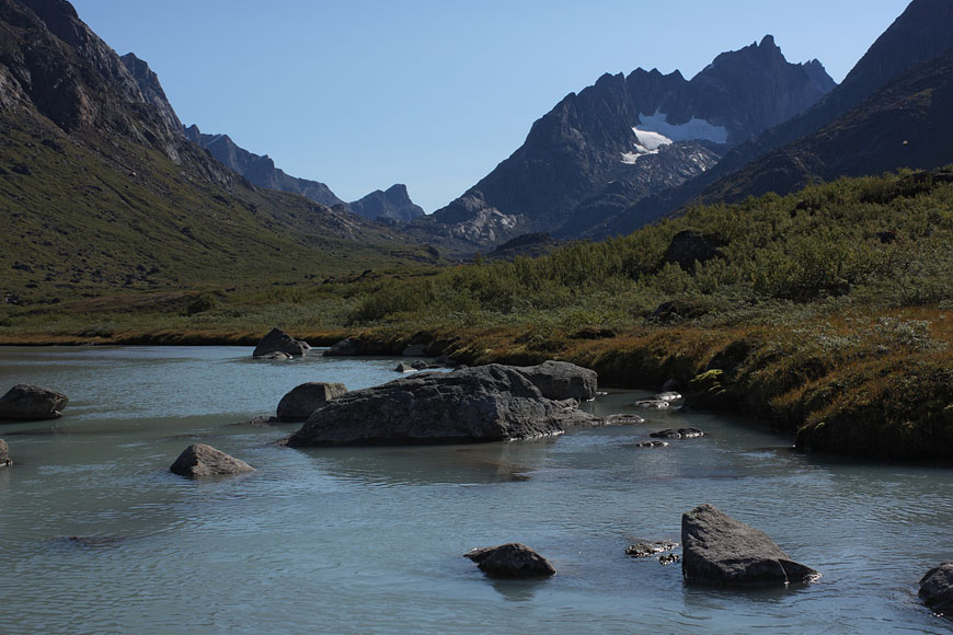
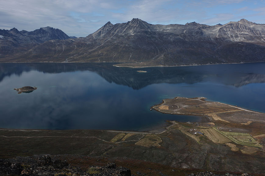
boating into Tasermiut fjorden |
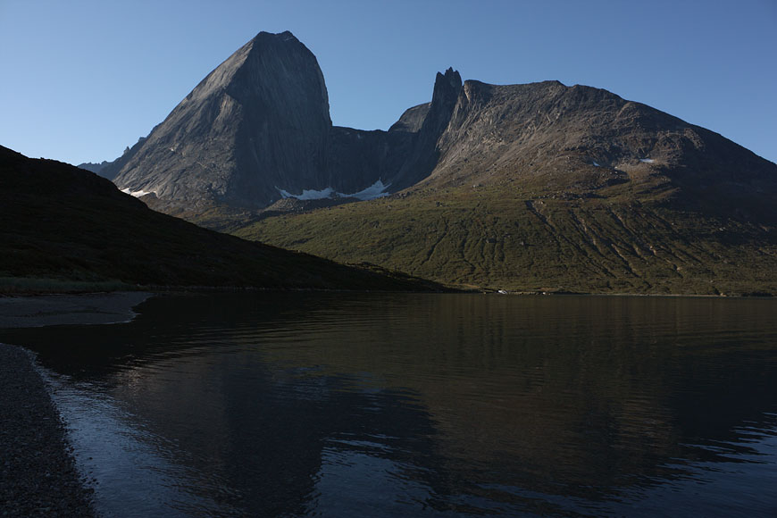
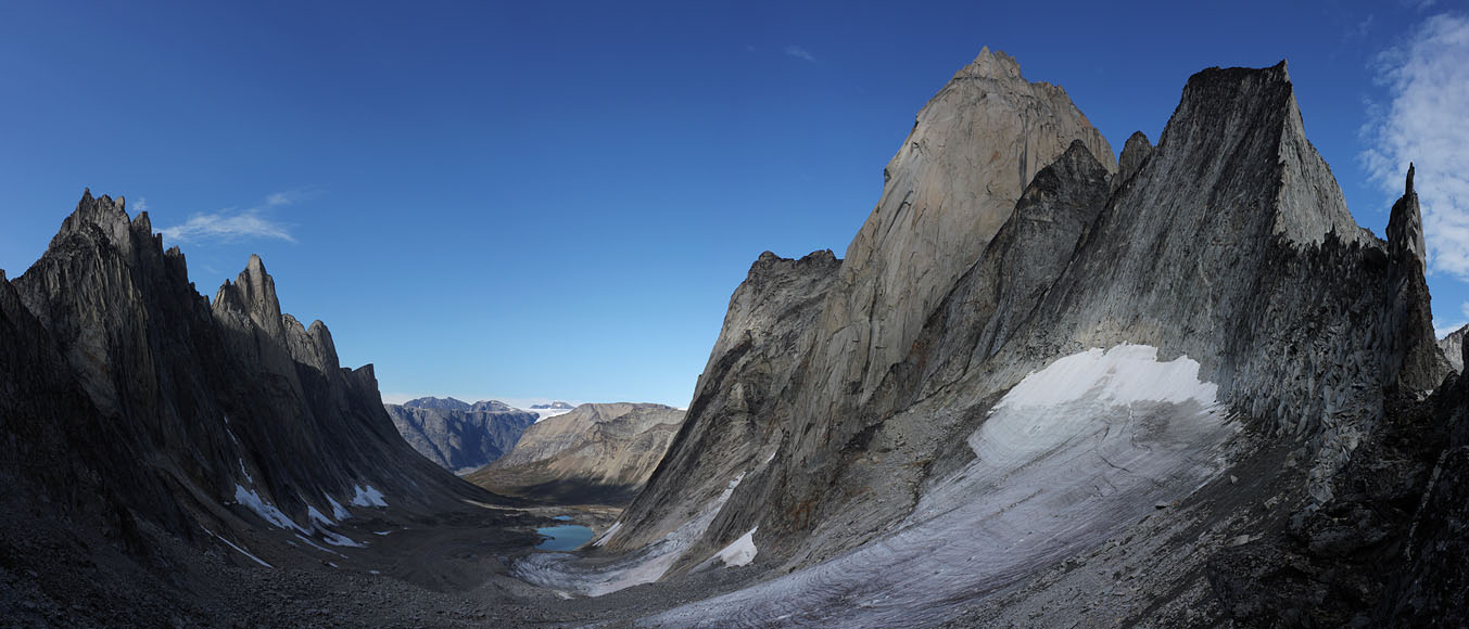
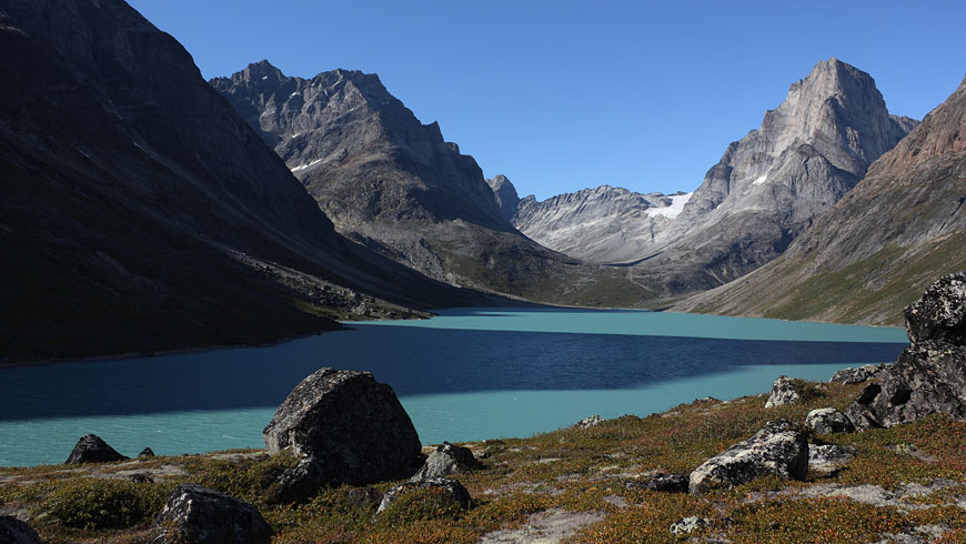
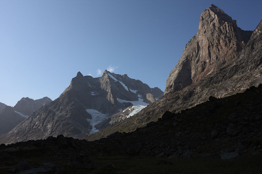
first view to the mountain range beeing my home for the coming weeks |
Inuit boat leaving me behind in Klosterdalen - this will be my last view of any humans for the coming weeks |
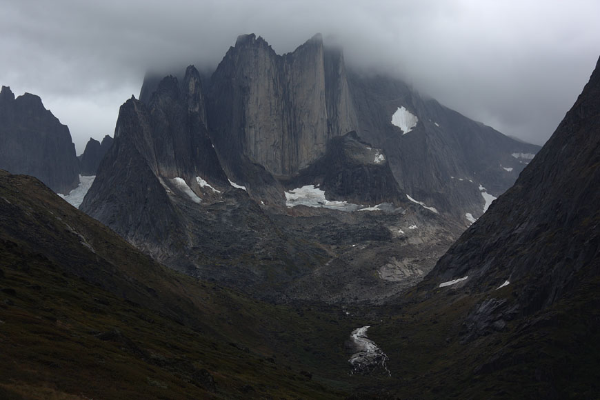
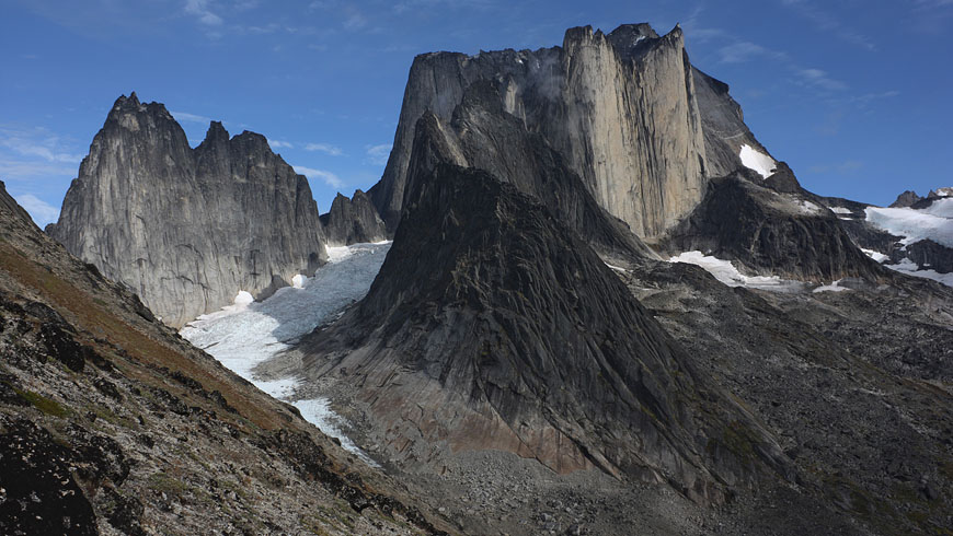
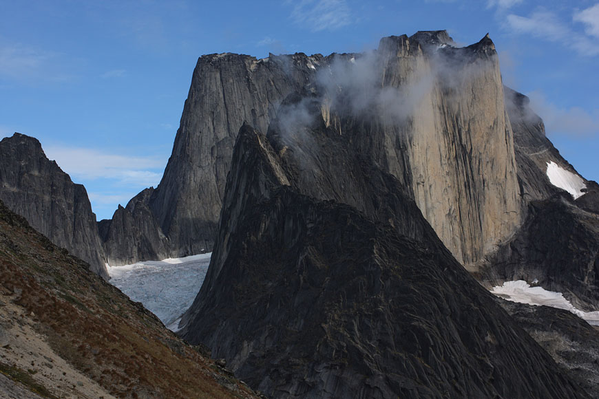
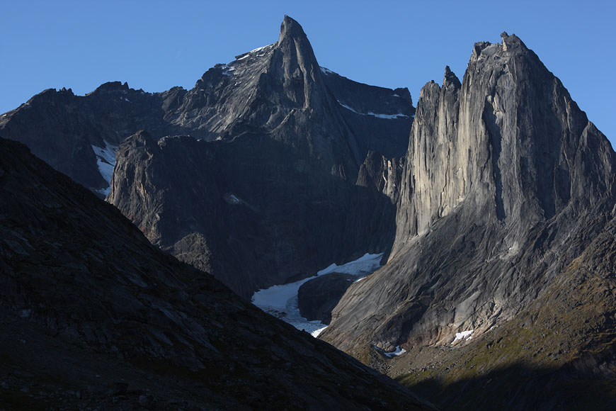
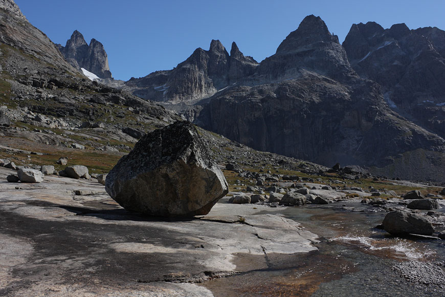
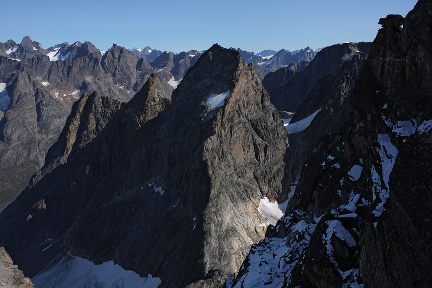
Tasermiut range can be called as the Patagonia of Greenland, uncomparable 1000m rock walls in abundance |
in summer these mountains are the paradise for extreme climbers |
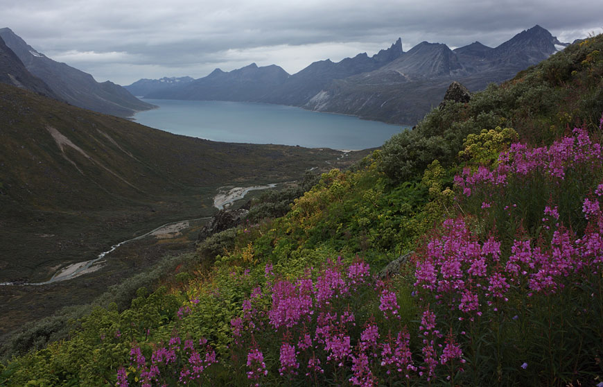
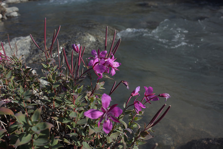
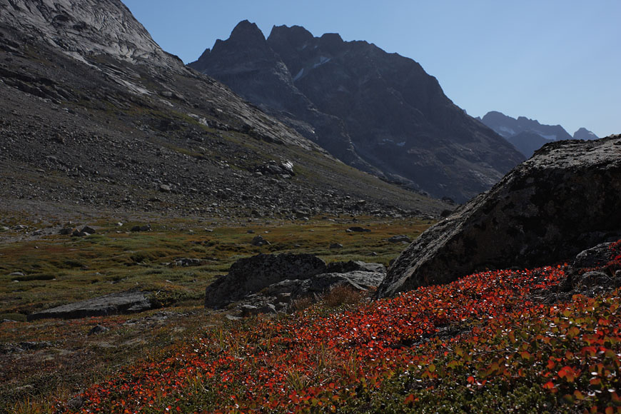
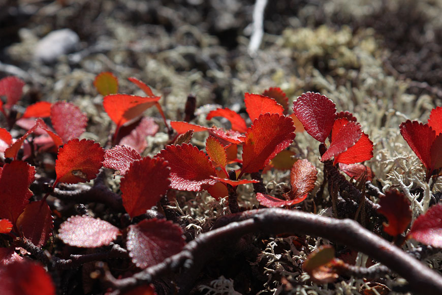
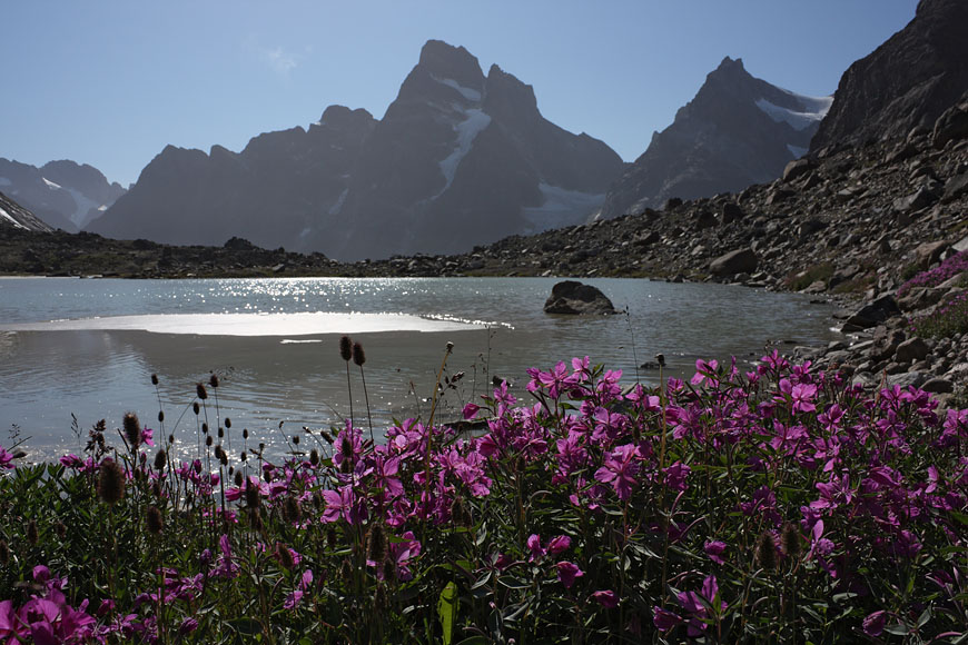
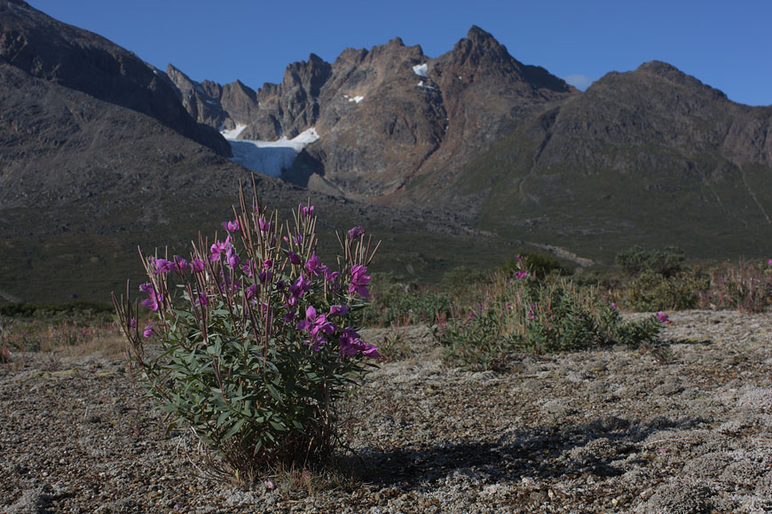
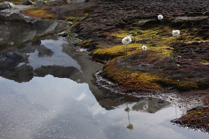
late arctic summer with still flowering vegetation |
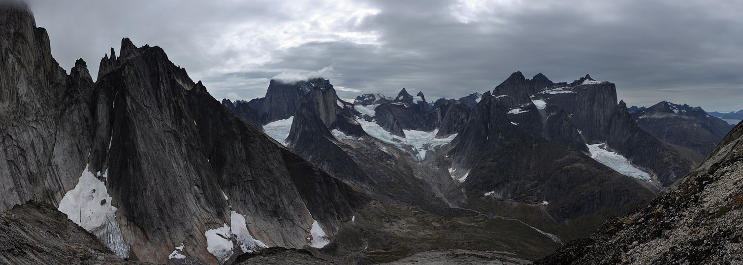
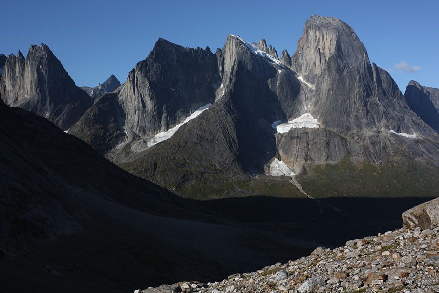
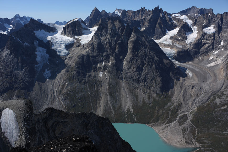
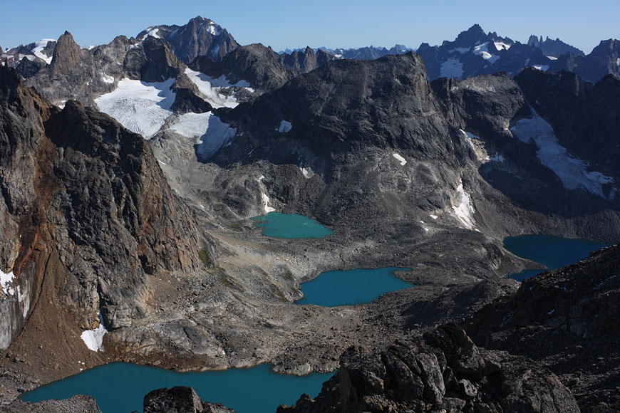
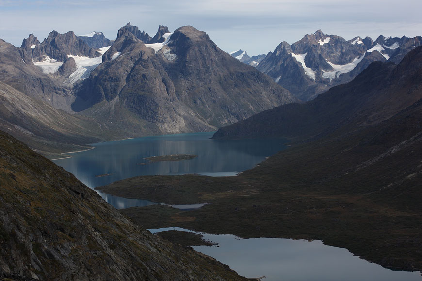
panoramic view from Ketil range |
view to S, bizarre mountaintops as far as the eye rechaes |
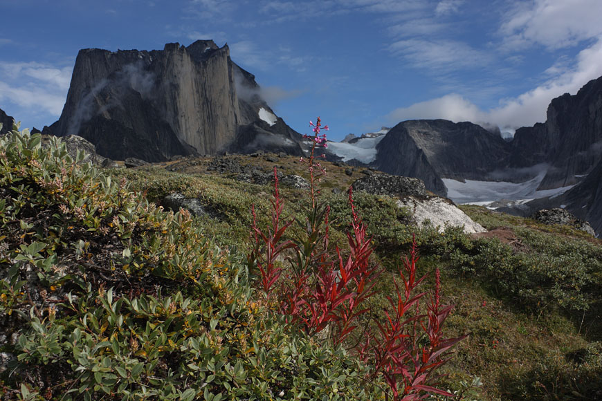
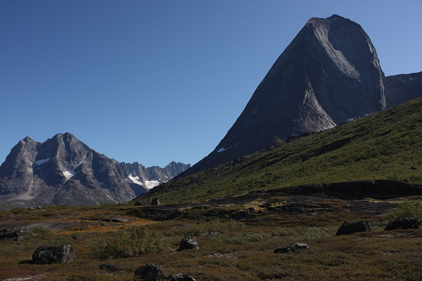
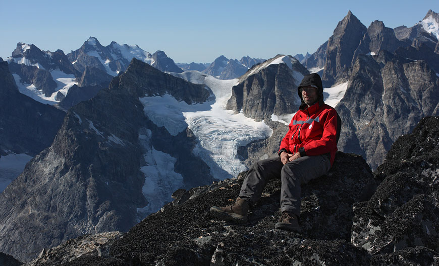
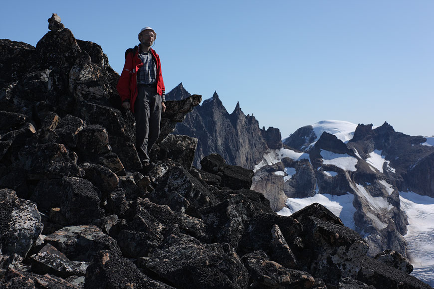
standing near to the dominant Ketil summit, towering more than 2000m above the sea, beeing still 500m below its summit |
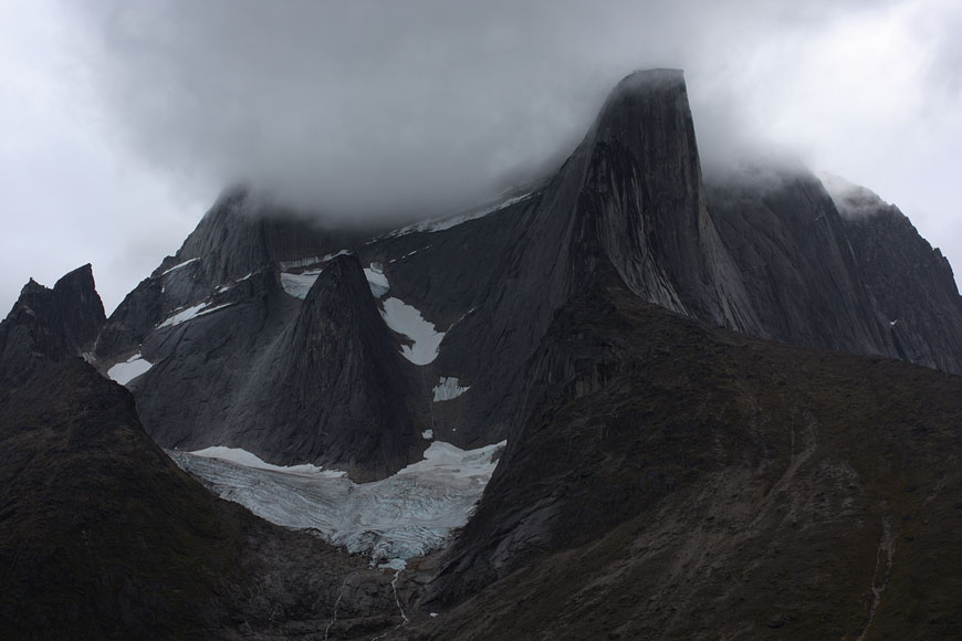
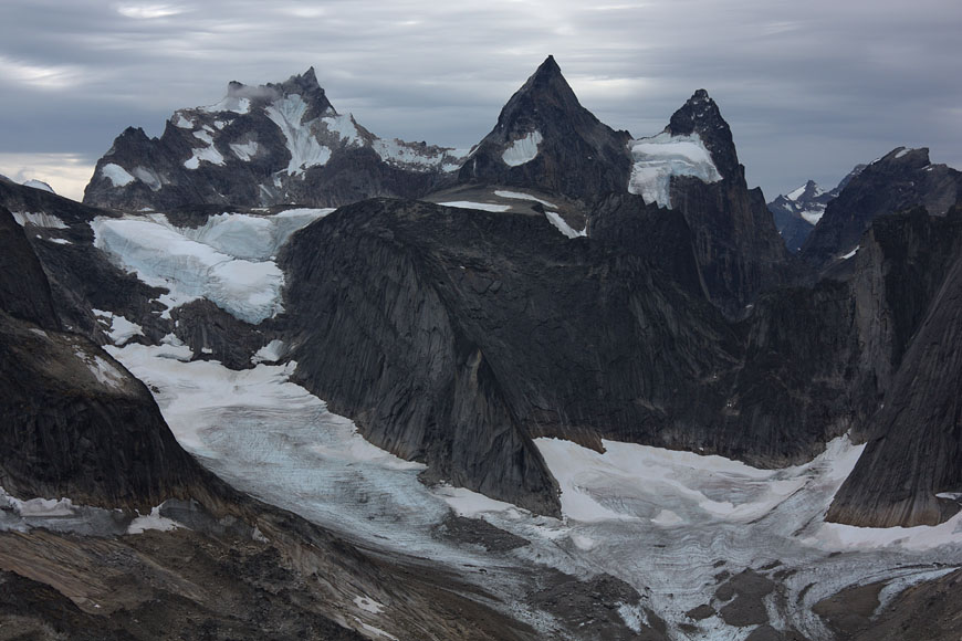
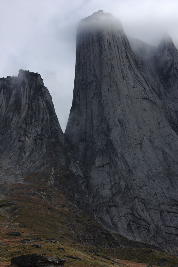
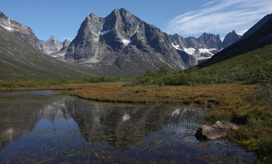
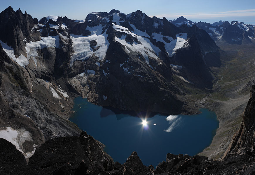
view to the famous Nalumasortoq |
|
|
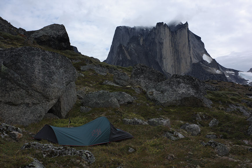
my first high camp |
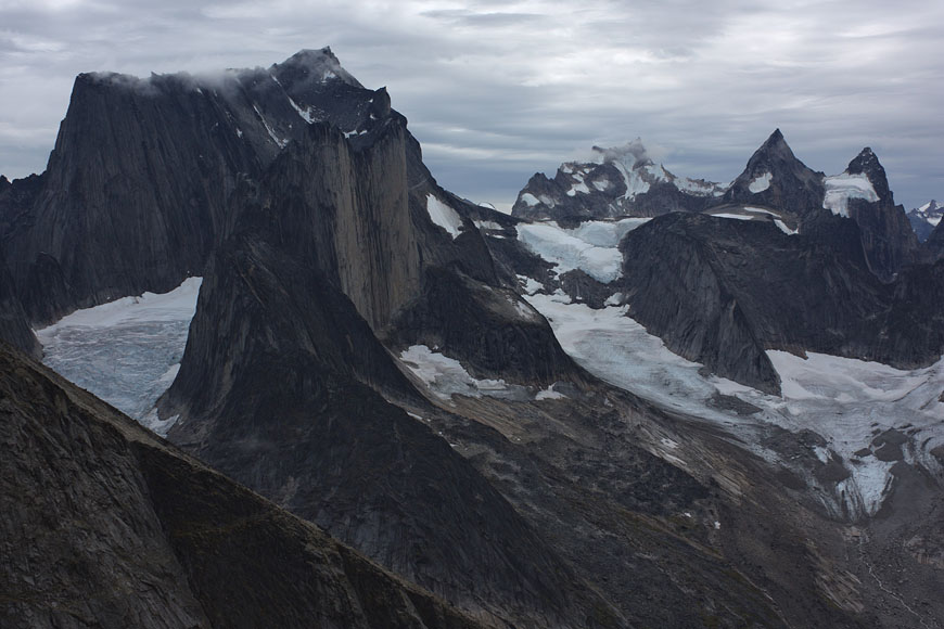
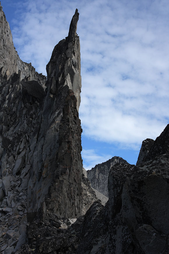
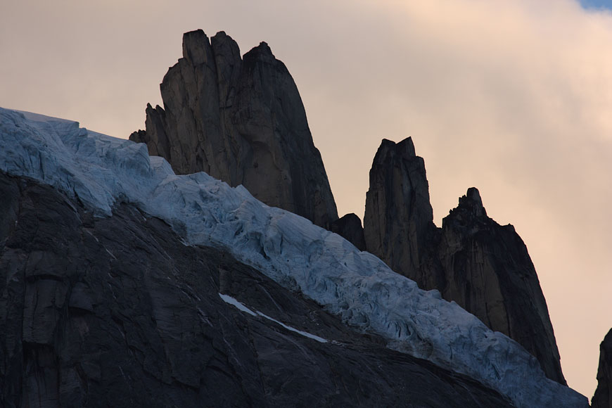
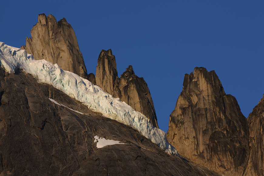
Kirkespiret to the west |
view back to Nalumasortoq |
|
Nalumasortoq |
Nalumasortoq |
|
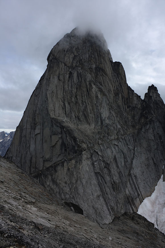
standing below the unbelievable 1000m cylinder of Ulamertorsuaq |
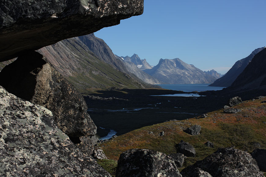
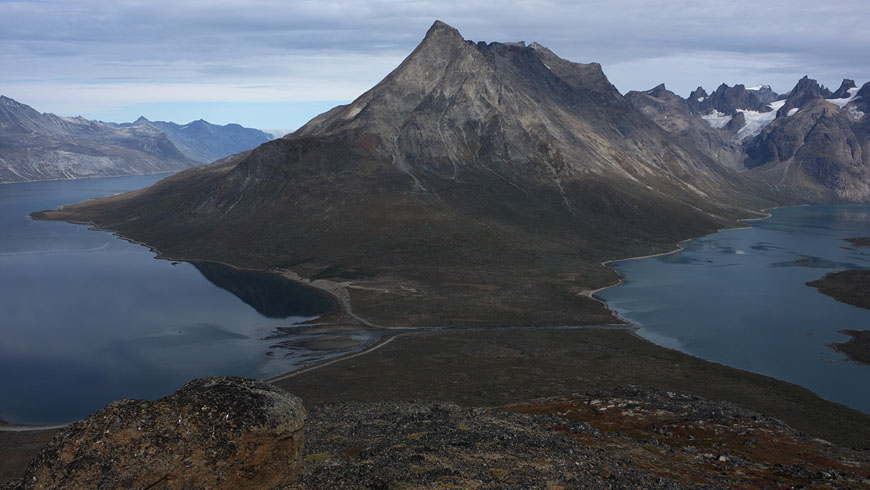
view back to the Tasermiut fjorden |
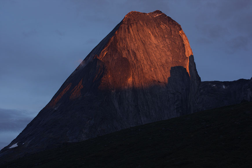
beeing back to my basecamp below 1400m high westwall of Ketil at sunset |
mountains to the east |
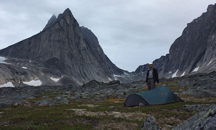
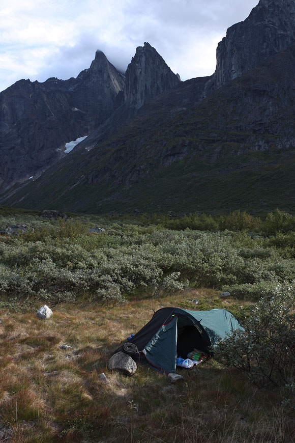
my basecamp in Klosterdalen |
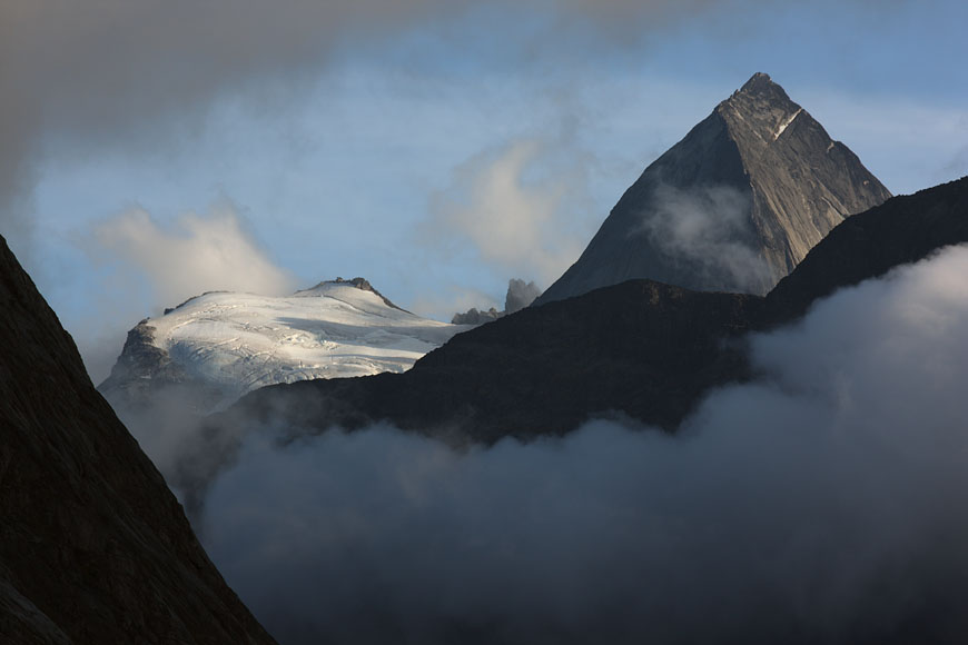
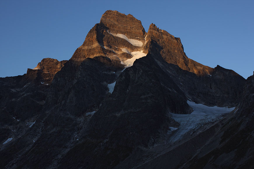
Ketil in morning light - seen on the way to Uiluiit |
|
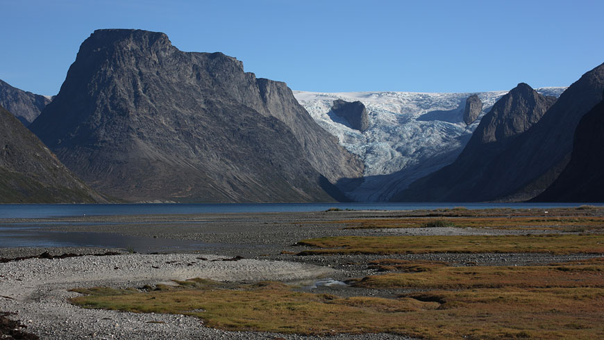
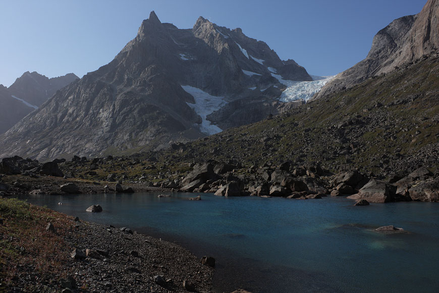
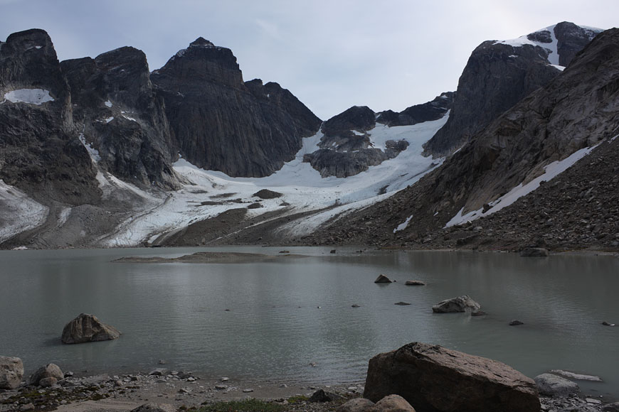
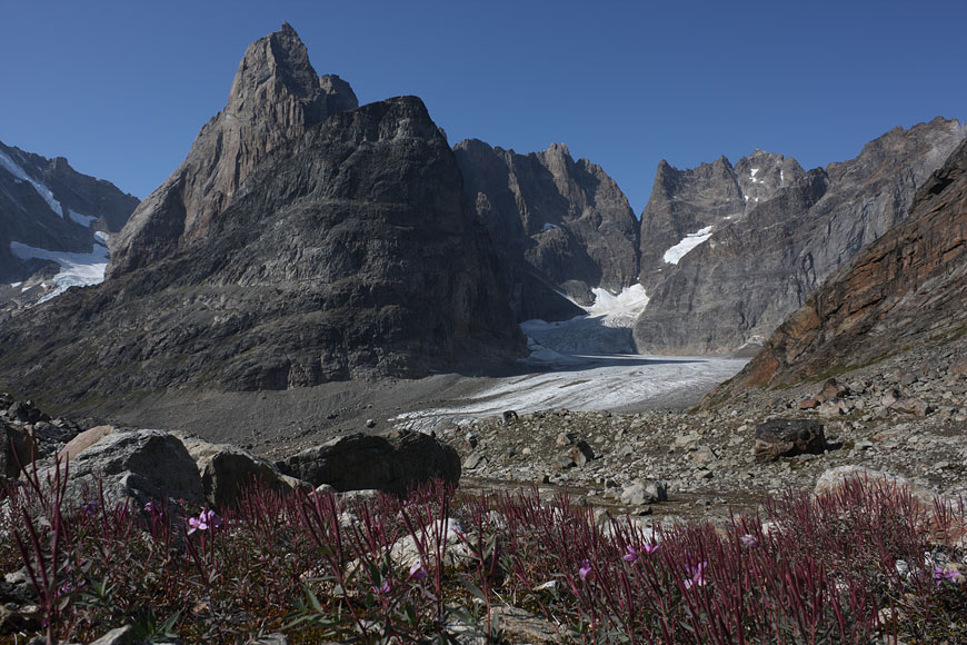
first view of Sermeq glacier defining the end of Tasermiut fjorden |
entering Tiningnertooq valley |
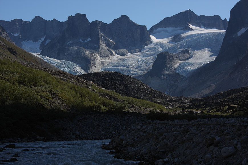
mountain range at the end of Tiningnertooq valley |
following glacier river |
finding the right pass leading to the following valley to the N is a difficult 1000m climbing task without any trails and steep rock walls between |
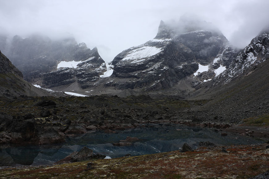
view back from the finally reached pass |
first panoramic view into the next valley - this is also the point of no return for the ascending route, distant lake promises utterly required drinking water |
the pass is a knife edge like rock ridge |
|
only one place allows crossing with easy II-grade climb |
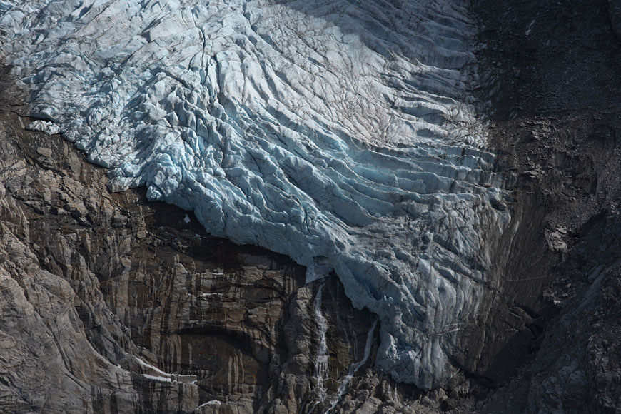
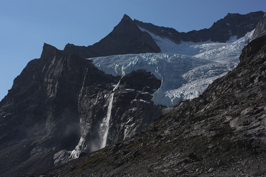
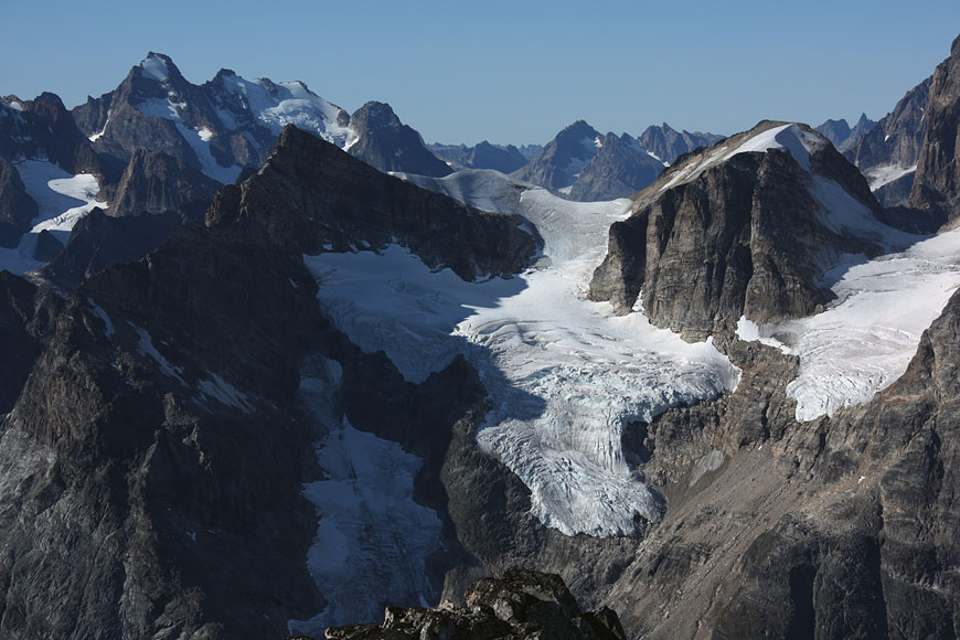
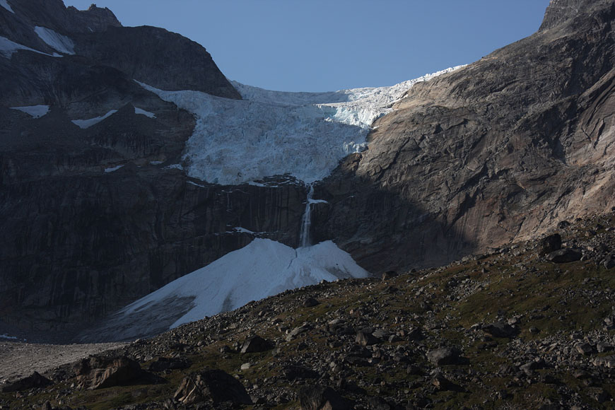
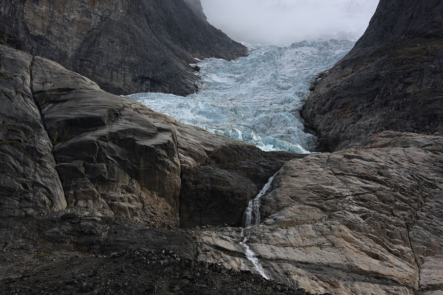
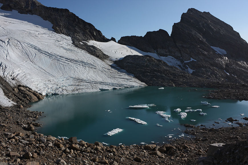
calving clacier above steep walls |
campsite after a long, strenuous day below towering Tininnertuup Qaqqaat summit, crossed pass behind |
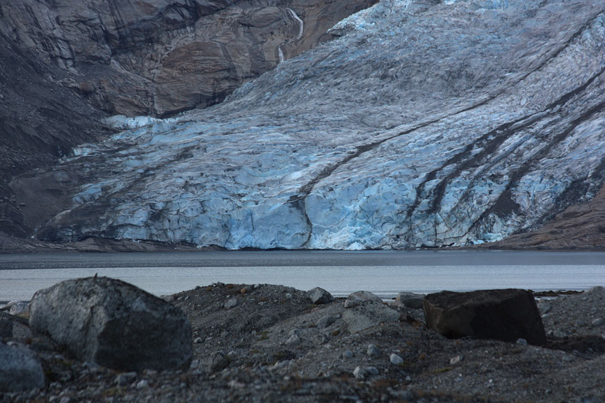
reaching Sermitsiaq glacier and again coastline of Tasermiut fjorden |
|
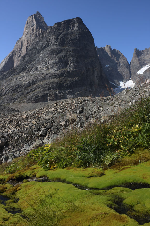
big mushrooms around |
Ketil summit in far distance |
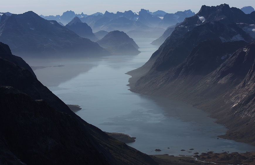
glacier breakup at the end of Tasermiut fjorden |
Sermitsiaq range |
following the partly steep and undescribed coastline back to Klosterdalen is a starkly thrilling task - beeing not able to make it would mean crossing the high mountain pass again with now limited resources |
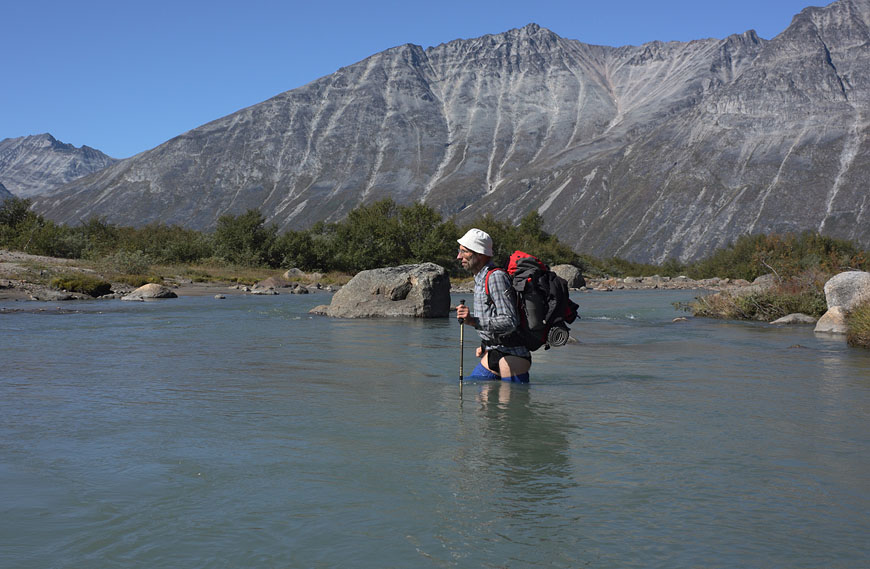
solo crossing the big Uliuiit glacier river is only sensible when conditions are perfect |
back to my basecamp below Ketil after a few days is a convenient experience |
entering Klosterdalen astonishes with extended marsh terrain giving wet surprises, soon to cross mountain pass behind |
|
leaving Klosterdalen to NE |
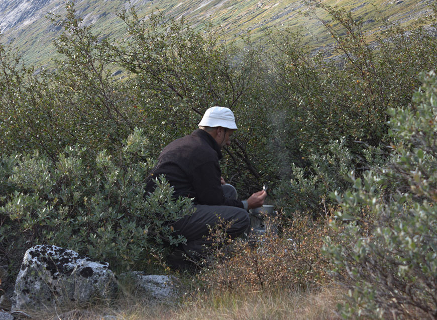
bush kitchen |
camp below pass to Tupaassat valley |
thundering glacier ice avalanches accompanying through the night |
glaciers defying gravity on top of 1000m rock walls |
sunset light |
|
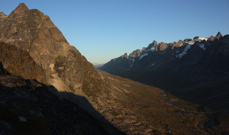
view back to Klosterdalen |
|
last view to Ketil range |
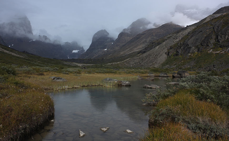
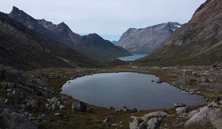
unnamed lake directly at the pass |
entering Tupaassat valley under hanging glaciers |
|
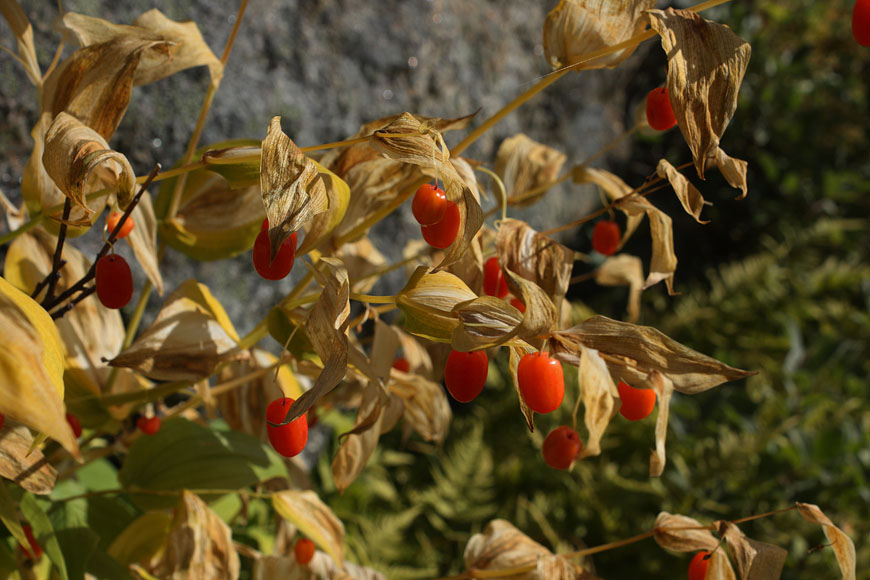
colors of fall are intensifying from day to day |
|
|
many lakes have to be circumnavigated before reaching Kangikitsoq fjord |
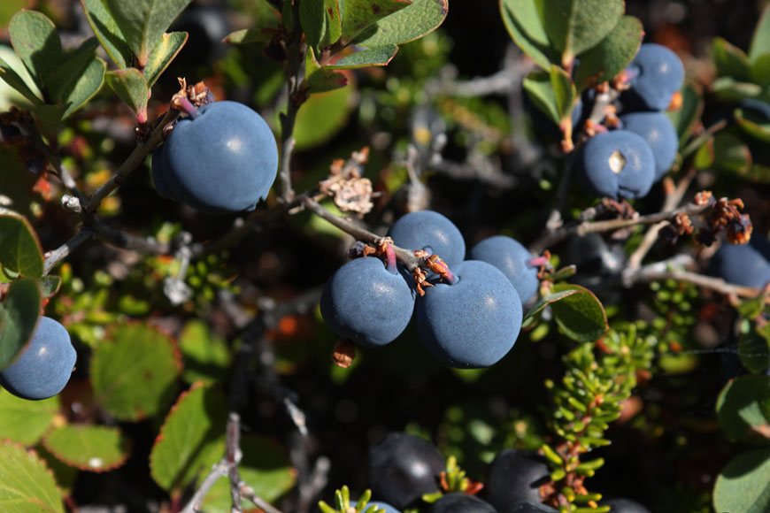
abundant blueberries giving additional food supply |
finding nice windcovered campsite used as basecamp for climbing excursion the following day |
view back to recently crossed pass while investigating planned climbing route |
still a long way to Kangikitsoq fjord... |
starting in first morning light |
steep mountaintops catching first sunlight |
while searching my way skywards it is time to decide for the easiest way to the summit |
view to my future destination, the Kangikitsoq fjord |
summit view to the E from my unnamed 1458m peak to another, 2106m high summit |
view to Qinnguadalen range in the distance, this will be my only possible way back to Tasermiut fjorden |
 |
|
Kangikitsoq fjord below |
me at the summit |
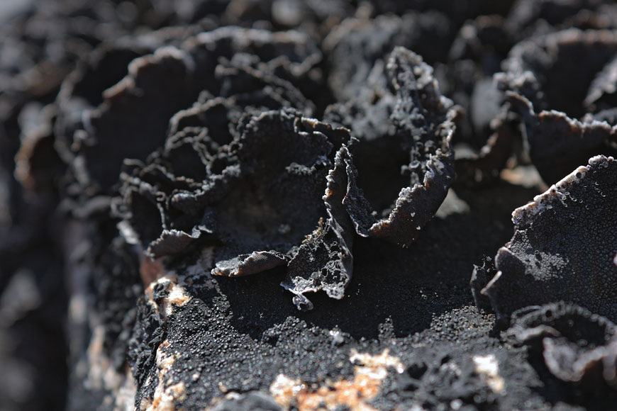
age old lichens sharp as a kife makes rock climbing unconvenient |
dominant 2106m peak to the east seen while descenting on the same way |
view down to the lake with by basecamp |
 |
back at the camp |
morning haze above soon to be reached Kangikitsoq fjord |
 |
ascending to the next pass for reaching Qinnguadalen was easy, but circumnavigating its lake meant dealing with a dangerous steep and icy part |
 |
 |
 |
walking down into Qinnguadalen |
 |
camsite between lakes... |
...and calving glaciers |
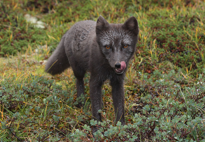
curious polar fox trying to catch my food, it developed into a hour long fight with damaged tent and backpack |
good to have crossed the pass yesterday-fresh snow fell in the night |
hanging glacier in the clouds |
view back into 15km long Qinnguadalen |
in Qinnguadalen one can find the biggest birch forest in Greenland - not exactly a nice experience fighting for hours against dense and spring-loaded birch bushes |
 |
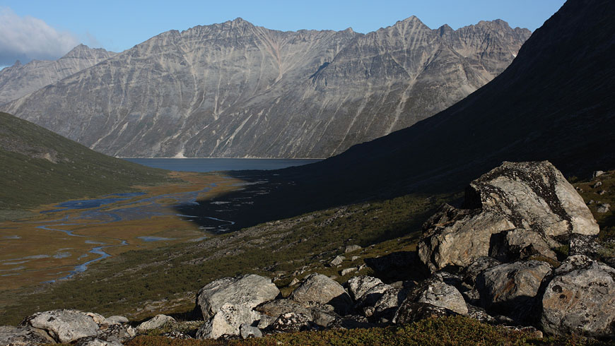
reaching the shoreline of Tasersuaq lake |
crossing of Qingeq river |
colors of fall |
 |
 |
reaching glacier lake at the end of Qingeq kujalleq valley, but glacier retreat melted the expected glacierfront away...so turning back to the lake |
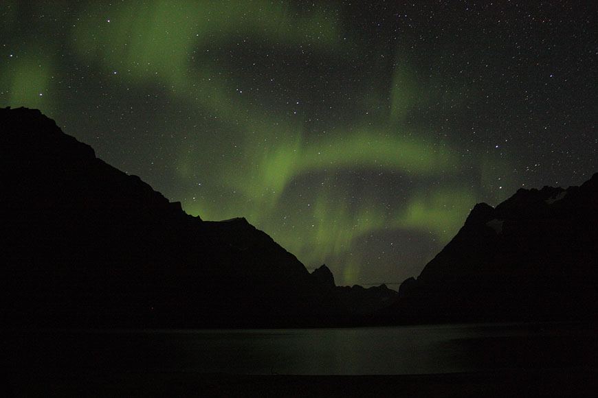
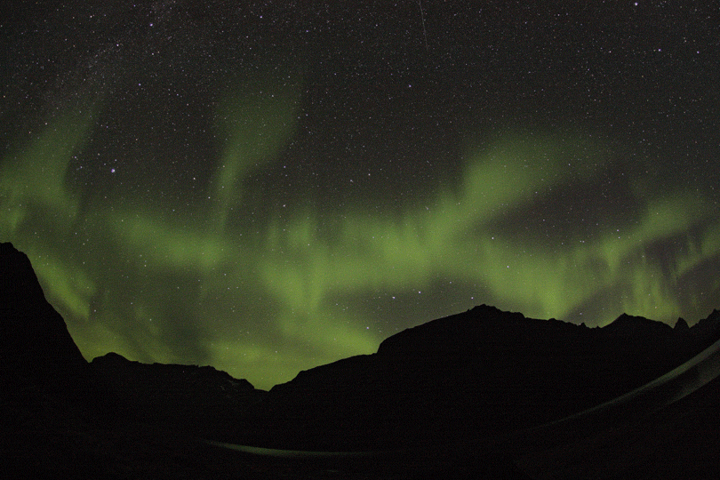
first sign of coming winter - northern lights seen from my camp at the shoreline of Tasersuaq lake |
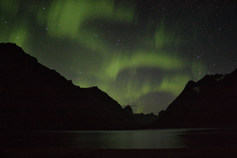
animation of northern lights |
animation of northern lights |
again discovering the unknown - trying to reach the Itillersuaq valley via undescribed and incalculable mountain pass |
for the crossing it was necessary to circumnavigate this impressive summit |
to investigate the steep ascent to this pass and to have a better view into this impressive mountainrange I tried to climb a unnamed 1368m peak to the E |
it turned out beeing possible to reach the very summit with a breathtaking view |
summit view to E showing unnamed lake 1000m directly below my feet, surrounded by steep mountains, seizable only with stitching multiple images |
 |
me at the summit after erecting maybe the first stone marker there |
after reaching the pass with very steep, but easy climbing it turned out to be a easy, but due to endless boulders strenuously long descent |
drifting ice |
the dominant peak E of the pass, now seen from its backside |
after reaching the upper Itillersuaq valley and beeing sure to reach the not too far away Inuit village I took another day off for climbing an unnamed 1100m peak having a beautiful sight back to the successfully crossed mountainrange with its colorful lakes |
descending to the camp |
comfortable camp in the grass... |
...with a beautiful view over Itillersuaq valley |
evening light |
still nice weather and enough time to climb the Qaqqatsiaq mountain - giving a wonderful view to Tasersuaq lake and the Qinnguadalen far behind |
and to the W side the Tasermiut fjorden |
panoramic view with Tasermiut fjorden to the left and Tasersuaq lake to the right |
the day after clouds rolled in and it started to rain heavily for many days, covering the peaks with fresh snow and bringing winter |
just right to reach Tasiusaq village and organizing a boat transfer to Nanortalik |
flying back to Narsarsuaq |
last iceberg before leaving Greenland |